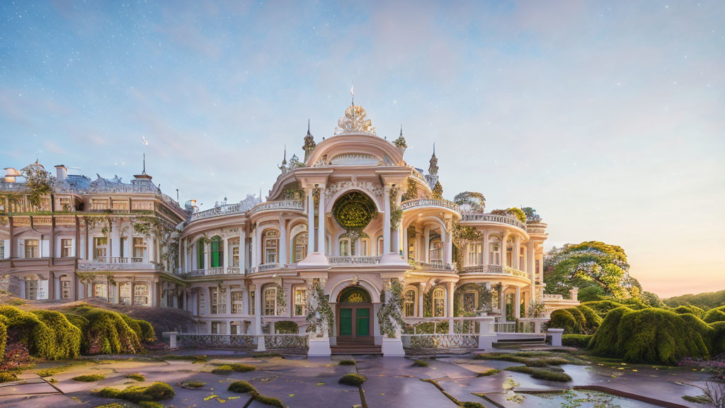
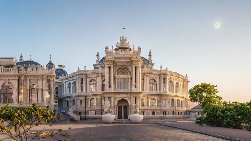
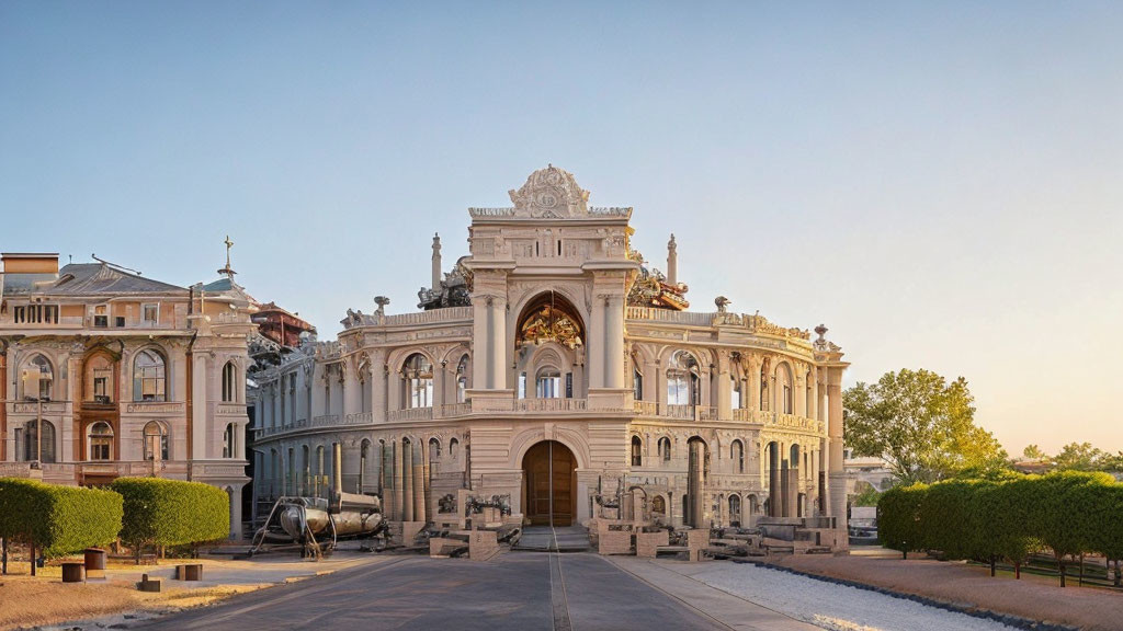
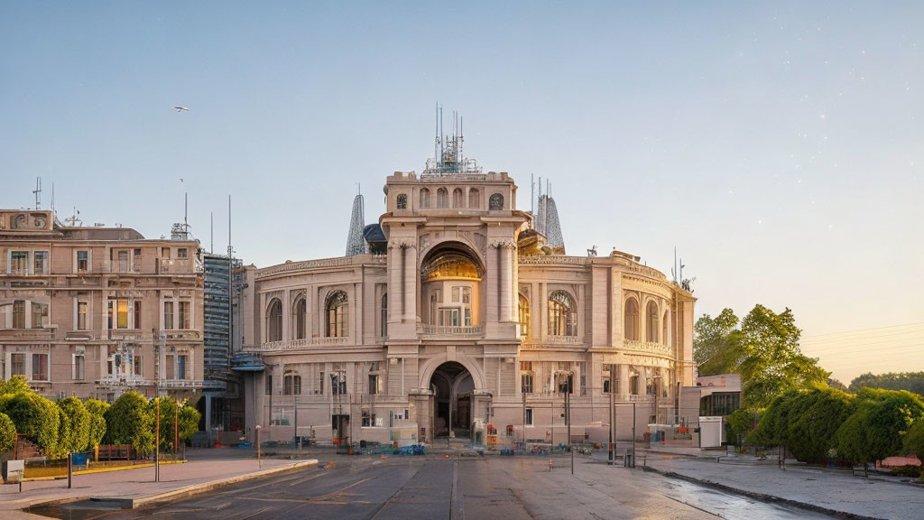
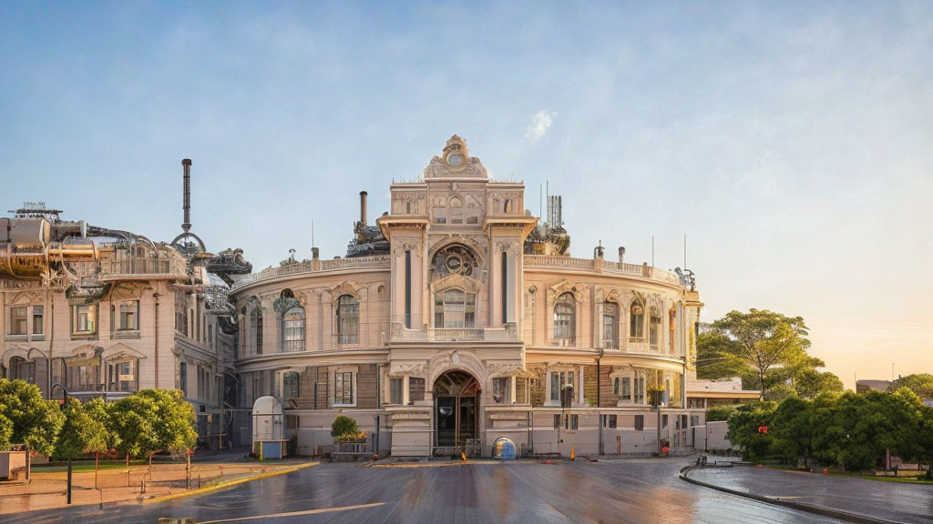
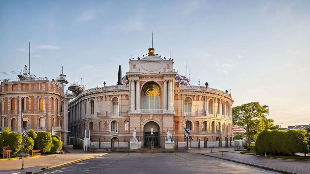
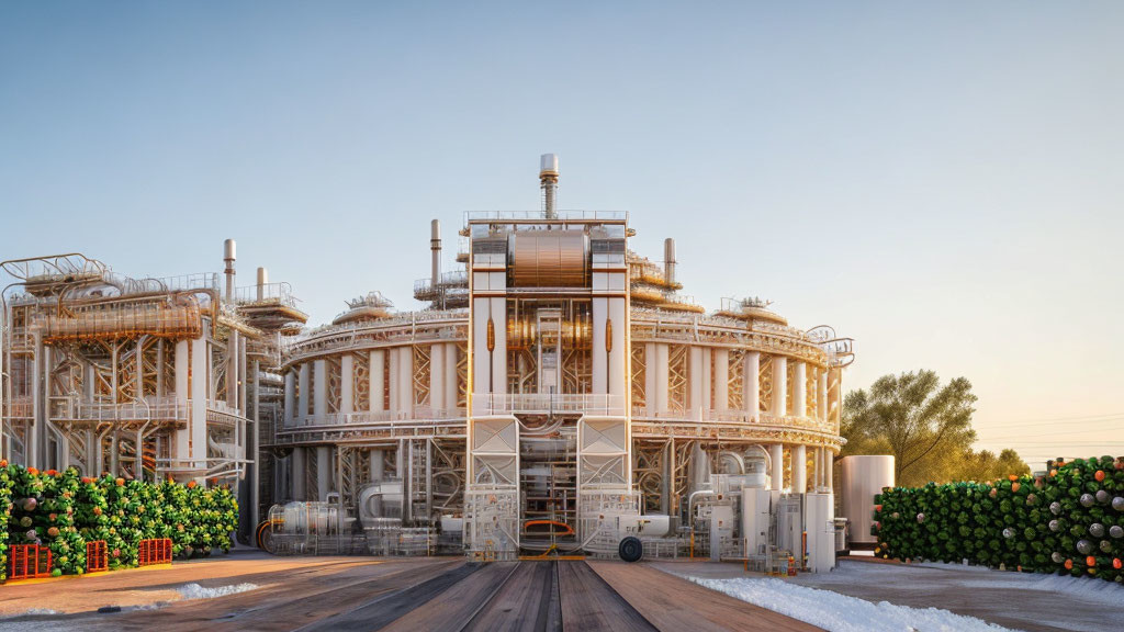
Prompt: Ruins of Loropéni. The 11,130m2 property, the first to be inscribed in the country, with its imposing stone walls is the best preserved of ten fortresses in the Lobi area and is part of a larger group of 100 stone enclosures that bear testimony to the power of the trans-Saharan gold trade. Situated near the borders of Côte d’Ivoire, Ghana and Togo, the ruins have recently been shown to be at least 1,000 years old. The settlement was occupied by the Lohron or Koulango peoples, who controlled the extraction and transformation of gold in the region when it reached its apogee from the 14th to the 17th century. Much mystery surrounds this site large parts of which have yet to be excavated. The settlement seems to have been abandoned during some periods during its long history. The property which was finally deserted in the early 19th century is expected to yield much more information. The dramatic and memorable Ruins of Loropéni consist of imposing, tall, laterite stone perimeter walls, up to six metres in height, surrounding a large abandoned settlement. As the best preserved of ten similar fortresses in the Lobi area, part of a larger group of around a hundred stone-built enclosu
Prompt: The Garden Kingdom of Dessau-Wörlitz is an exceptional example of landscape design and planning of the Age of the Enlightenment, the 18th century. Its diverse components - outstanding buildings, landscaped parks and gardens in the English style, and subtly modified expanses of agricultural land - serve aesthetic, educational, and economic purposes in an exemplary manner. The Garden Kingdom of Dessau-Wörlitz, located in Saxony-Anhalt in the Middle Elbe Region, is an exceptional example of landscape design and planning from the Age of the Enlightenment in the 18th century. Its diverse components – the outstanding buildings, English-style landscaped parks and gardens, and subtly modified expanses of agricultural land – served aesthetic, educational, and economic purposes in an exemplary manner.
Prompt: The museum as a social phenomenon owes its origins to the Age of Enlightenment in the 18th century. The five museums on the Museumsinsel in Berlin, built between 1824 and 1930, are the realization of a visionary project and show the evolution of approaches to museum design over the course of the 20th century. Each museum was designed so as to establish an organic connection with the art it houses. The importance of the museum's collections – which trace the development of civilizations throughout the ages – is enhanced by the urban and architectural quality of the buildings. The Berlin Museumsinsel is a complex of buildings composed of individual museums of outstanding historical and artistic importance located in the heart of the city. The five museums, built between 1824 and 1930 by the most renowned Prussian architects, represent the realization of a visionary project and the evolution of the approaches to museum design over this seminal century. They form a unique ensemble that serves purely museological purposes and constitutes a town-planning highlight in the urban fabric as a kind of city crown.
Prompt: The World Heritage properties comprises twelve separate buildings or ensembles: Goethe's House and Goethe´s Garden and Garden House; Schiller's House; Herder Church, Herder House and Old High School; Residence Castle and Ensemble Bastille; Dowager's Palace (Wittumspalais); Duchess Anna Amalia Library; Park on the Ilm with the Roman House; Belvedere Castle and Park with Orangery; Ettersburg Castle and Park; Tiefurt Castle and Park; and Historic Cemetery with Princes´ Tomb.
Prompt: Between 1919 and 1933 the Bauhaus movement revolutionized architectural and aesthetic thinking and practice in the 20th century. The Bauhaus buildings in Weimar, Dessau and Bernau are fundamental representatives of Classical Modernism, directed towards a radical renewal of architecture and design. This property, which was inscribed on the World Heritage List in 1996, originally comprised buildings located in Weimar (Former Art School, the Applied Art School and the Haus Am Horn) and Dessau (Bauhaus Building, the group of seven Masters' Houses). The 2017 extension includes the Houses with Balcony Access in Dessau and the ADGB Trade Union School in Bernau as important contributions to the Bauhaus ideas of austere design, functionalism and social reform.
Prompt: The ironworks, which cover some 6 ha, dominate the city of Völklingen. Although they have recently gone out of production, they are the only intact example, in the whole of western Europe and North America, of an integrated ironworks that was built and equipped in the 19th and 20th centuries and has remained intact. The Völklingen Ironworks in western Germany close to the border with France cover 6 ha and are a unique monument to pig-iron production in Western Europe. No other historic blast-furnace complex has survived that demonstrates the entire process of pig-iron production in the same way, with the same degree of authenticity and completeness, and is underlined by such a series of technological milestones in innovative engineering. The Völklingen monument illustrates the industrial history of the 19th century in general and also the transnational Saar-Lorraine-Luxembourg industrial region in the heart of Europe in particular. The Ironworks are a synonym for and a symbol of human achievement during the First and Second Industrial Revolutions in the 19th and beginning of the 20th centuries.
Prompt: Quedlinburg, in the Land of Sachsen-Anhalt, was a capital of the East Franconian German Empire at the time of the Saxonian-Ottonian ruling dynasty. It has been a prosperous trading town since the Middle Ages. The number and high quality of the timber-framed buildings make Quedlinburg an exceptional example of a medieval European town. The Collegiate Church of St Servatius is one of the masterpieces of Romanesque architecture. Quedlinburg, in the State of Sachsen-Anhalt, was a capital of the East Franconian German Empire at the time of the Saxonian-Ottonian ruling dynasty (919 to 1024). It has been a prosperous trading town since the Middle Ages. The number and high quality of the timber-framed buildings make Quedlinburg an exceptional example of a medieval European town.
Prompt: The Upper Harz mining water management system, which lies south of the Rammelsberg mines and the town of Goslar, has been developed over a period of some 800 years to assist in the process of extracting ore for the production of non-ferrous metals. Its construction was first undertaken in the Middle Ages by Cistercian monks, and it was then developed on a vast scale from the end of the 16th century until the 19th century. It is made up of an extremely complex but perfectly coherent system of artificial ponds, small channels, tunnels and underground drains. It enabled the development of water power for use in mining and metallurgical processes. It is a major site for mining innovation in the western world. The copper, lead and tin mines of Rammelsberg mountain, in the Harz region, were worked continuously from the 11th century until the 1980s. They bear outstanding testimony to mining installations and practices in Europe, both in terms of surface and underground remains, particularly from the Middle Ages and the Renaissance period.
Prompt: In the 4th century, a remarkable series of decorated tombs were constructed in the cemetery of the Roman provincial town of Sopianae (modern Pécs). These are important both structurally and architecturally, since they were built as underground burial chambers with memorial chapels above the ground. The tombs are important also in artistic terms, since they are richly decorated with murals of outstanding quality depicting Christian themes. In the 4th century A.D. a remarkable series of decorated tombs were constructed in the cemetery in the town of Sopianae, in the Roman Province of Pannonia, the ruins of which survived under the ground and are situated in the current city of Pécs, in South Hungary. The burial chambers, chapels and mausoleum excavated on the site of the Sopianae cemetery form a complex that bears witness to an ancient culture and civilization that had a lasting impact. It is the richest collection of structural types of sepulchral monuments in the northern and western Roman provinces reflecting a diversity of cultural sources.
Prompt: The ancient city of Ashur is located on the Tigris River in northern Mesopotamia in a specific geo-ecological zone, at the borderline between rain-fed and irrigation agriculture. The city dates back to the 3rd millennium BC. From the 14th to the 9th centuries BC it was the first capital of the Assyrian Empire, a city-state and trading platform of international importance. It also served as the religious capital of the Assyrians, associated with the god Ashur. The city was destroyed by the Babylonians, but revived during the Parthian period in the 1st and 2nd centuries AD. Criterion iii: Founded in the 3rd millennium BCE, the most important role of Ashur was from the 14th to 9th century BCE when it was the first capital of the Assyrian empire. Ashur was also the religious capital of Assyrians, and the place for crowning and burial of its kings. Criterion iv: The excavated remains of the public and residential buildings of Ashur provide an outstanding record of the evolution of building practice from the Sumerian and Akkadian period through the Assyrian empire, as well as including the short revival during the Parthian period.
Prompt: The attributes of the Outstanding Universal Value of the property are sufficiently intact. These include environmental conditions (geology, morphology, hydrology and climate) favourable for specialized vine- growing, historic vineyards /terroirs, long established settlements and their network, rich cultural heritage reflecting ethnic diversity, diverse types of cellars and a great diversity of other buildings contributing to the character of the landscape and related to vine-growing and wine production (e.g. terraces, built stone walls and hedges, reservoirs). The property embraces most of the attributes necessary to express the Outstanding Universal Value. However, the relationship between the property and its buffer zone needs further review as well as the external boundaries of the buffer zone. Within the context of changing economic demands, the continuity of traditional land use is sustained. In the long term, disappearance of wetlands and the expansion of built-in areas as well as climate change should be considered as potential threats.
Prompt: Architectural Planning Juries, both at the level of the districts and at the level of the Capital of Budapest, facilitate high quality architectural developments in accordance with the values of the property. The Gyula Forster National Centre for Cultural Heritage Management is the World Heritage Management Body. Based on the national World Heritage Act of 2011, the state of conservation of the property, as well as threats and preservation measures will be regularly monitored and reported to the National Assembly, while the management plan will be reviewed at least every seven years. Once finalised and approved, the management plan and the management body provide transparent governance arrangements with clear responsibilities, where different interests can manifest themselves and where the institutional framework and methods for the cooperation of the different stakeholders are available.
Prompt: As a centre for receiving and disseminating cultural influences, Budapest is an outstanding example of urban development in Central Europe, characterised by periods of devastation and revitalisation. Budapest has retained the separate structural characteristics of the former cities of Pest, Buda and Óbuda. One example thereof is the Buda Castle Quarter with its medieval and characteristically Baroque style, which are distinct from the extended and uniquely homogeneous architecture of Pest (with its historicising and art nouveau styles) which is characterised by outstanding public buildings and fitted into the ringed-radial city structure. All this is organized into a unity arising from the varied morphological characteristics of the landscape and the Danube, the two banks of which are linked by a number of bridges. The urban architectural ensemble of the Andrássy Avenue (‘The Avenue’) and its surroundings (Heroes' Square, the City Park, historic inner city districts and public buildings) are high-quality architectural and artistic realisations of principles of urbanism reflecting tendencies, which became widespread in the second part of the 19th century.
Prompt: Inhabited since the 2nd century A.D., Quirigua had become during the reign of Cauac Sky (723–84) the capital of an autonomous and prosperous state. The ruins of Quirigua contain some outstanding 8th-century monuments and an impressive series of carved stelae and sculpted calendars that constitute an essential source for the study of Mayan civilization. Quirigua is one of the major testimonies to the Mayan civilization. For reasons which are not clear, it then entered a period of decline. It is known that, at the time of the arrival of the European conquerors, the control of the jade route had been taken over by Nito, a city closer to the Caribbean coast. Although Quirigua has retained ruins and vestiges of dwellings ranging between AD 200 and AD 900, most of the monuments that ensure Quirigua its world-wide reknown date from the 8th century, the period during which the city was entirely remodelled in accordance with its function as royal residence and administrative centre.
Prompt: The mining region of Erzgebirge/Krušnohoří bears exceptional testimony to technological, scientific, administrative, educational, managerial and social aspects that underpin the intangible dimension of living traditions, ideas and beliefs of the people associated with the Ore Mountains’ culture. The organization as well as its hierarchical administration and management are fundamental to understanding the mining tradition of the Ore Mountains that developed from the beginning of the 16th century. A tradition emerged whereby the mining bureaucracies of absolute rulers maintained strict control of the work force and induced a favourable climate for an early capitalistic system of financing. Such an approach influenced the economic, legal, administrative and social system of mining in all the mining regions of continental Europe. The state-controlled mining organization strongly influenced the development of early modern monetary systems, particularly witnessed by the royal mint in Jáchymov, where the heavy silver coins known as thalers, first minted from 1520, served for several centuries as a standard for the monetary systems in many European countries.
Prompt: The Costiera Amalfitana, stretches along the southern coast of the Sorrentine Peninsula in Salerno province and can rightly be defined as a landscape of outstanding cultural value, thanks to the astonishing work of both nature and humankind. Its dramatic topography and historical evolution have produced exceptional cultural and natural scenic values. Nature is both unspoiled and harmoniously fused with the results of human activity. The landscape is marked by rocky areas, wood and maquis, but also by citrus groves and vineyards, grown wherever human beings could find a suitable spot. The Costiera Amalfitana covers 11,231 hectares, a large area that encompasses 15 municipalities, agricultural lands and three natural reserves. The region has been populated since prehistoric times as illustrated by the Palaeolithic and Mesolithic remains found at Positano. While it became a Roman colony in the 4th century, the region has been intensively settled since the beginning of Middle Ages.
Prompt: Together Modena’s magnificent 12th century cathedral and soaring bell tower serve as a supreme example of early Romanesque art comprised of exceptional architectural and sculptural quality. In addition to the cathedral and spectacular civic tower, also known as “Ghirlandina”, the property includes the Piazza Grande surrounded by the City Hall, and the Archishopric and a part of the canonical buildings and the sacristry to the north. The entire property is relatively small, covering 1.2 ha surrounded by a buffer zone of 1.1 ha. Attributed to the architect Lanfranco, the cathedral was begun in 1099, replacing an early Christian basilica, and is the home of the mortal remains of Saint Geminiano, the patron saint of Modena (4th century). The building is covered with ancient roman stones, linking it to the splendour of the temples of antiquity. Wiligelmo’s rich sculptures are found on both external walls and the interior capitals. The bell tower, started in the beginning of the 12th century, is of similar style and materials. Originally a five-storey structure, it was completed in 1319 with an octagonal section and additional decoration.
Prompt: The monumental complex at Caserta, created by the Bourbon king Charles III in the mid-18th century to rival Versailles and the Royal Palace in Madrid, is exceptional for the way in which it brings together a magnificent palace with its park and gardens, as well as natural woodland, hunting lodges and a silk factory. It is an eloquent expression of the Enlightenment in material form, integrated into, rather than imposed on, its natural setting. The Royal Palace is the centrepiece of the whole architectural composition and is located on a central axis which connects and unifies the entire complex. The portico and the stream of the fountains in the park which lead to the scenic backdrop of the waterfall, formed by the Aqueduct Carolino, are also situated along this axis. The Aqueduct Carolino, with its imposing viaduct “Ponti della Valle” is a stunning work of engineering and provides an extraordinary infrastructure not only serving the palace, the gardens and the future capital of the kingdom, but also the mills, the ironworks and the manufacturing industries located along its path.
Prompt: The beauty of the solitary, often snow-capped, stratovolcano, known around the world as Mount Fuji, rising above villages and tree-fringed sea and lakes has long been the object of pilgrimages and inspired artists and poets. The inscribed property consists of 25 sites which reflect the essence of Fujisan’s sacred and artistic landscape. In the 12th century, Fujisan became the centre of training for ascetic Buddhism, which included Shinto elements. On the upper 1,500-metre tier of the 3,776m mountain, pilgrim routes and crater shrines have been inscribed alongside sites around the base of the mountain including Sengen-jinja shrines, Oshi lodging houses, and natural volcanic features such as lava tree moulds, lakes, springs and waterfalls, which are revered as sacred. Its representation in Japanese art goes back to the 11th century, but 19th century woodblock prints of views, including those from sand beaches with pine tree groves have made Fujisan an internationally recognized icon of Japan and have had a deep impact on the development of Western art.
Dream Level: is increased each time when you "Go Deeper" into the dream. Each new level is harder to achieve and
takes more iterations than the one before.
Rare Deep Dream: is any dream which went deeper than level 6.
Deep Dream
You cannot go deeper into someone else's dream. You must create your own.
Deep Dream
Currently going deeper is available only for Deep Dreams.